How You Can Easily Use Google Maps To Relive Nostalgia

Google Maps is an online service created by Google that helps you find places and navigate around. It provides detailed maps for cities and countries worldwide, letting you see streets, landmarks, and even get directions for driving, walking, biking, or public transit. You can explore a street-level view with the Street View feature and check out businesses, like restaurants and shops, along with reviews and ratings. The service also includes satellite imagery and real-time traffic updates for better route planning. Google Maps is available on the web and as a mobile app for easy access, and it’s a handy tool for getting around, discovering new places, and finding local businesses. It was designed for Navigation but how can it be useful for a nostalgia-focused experience?

How do you use Google Maps for nostalgia?

On the Desktop and mobile versions of Google Maps, when you’re in street view, you can select from a variety of captures taken by Google employees of streets and maps from 2007 to the current year. Early captures of Google Maps were typically taken from roads and highways capturing iconic landmarks that are no longer around. So if you’re having trouble looking for a parking lot business in a strip mall, try using the main road’s perspective to get the oldest dates closest to the 2007 launch of Google Maps.

How to access Street View [INSTRUCTIONS]

Desktop

Use the search bar to find the location you want to explore. Once you’ve located the area, drag the little yellow Pegman icon located in the bottom right corner of the screen onto the map. Streets with available Street View imagery will be highlighted in blue. You can navigate by clicking and dragging with your mouse. To move along the streets, click on the arrows overlaid on the roads.

Mobile

Locate the Google Maps app on your mobile device and open it. Use the search bar to find the location you want to explore. Once you find the location, drop a pin by tapping and holding on the map at the desired spot. At the bottom of the screen, you’ll see a bar with information about the location. Swipe up on this bar to reveal more details. Look for a small Street View thumbnail. Tap on it to enter Street View. You can now navigate through the streets by dragging your finger on the screen. Move the phone around to change your viewing direction, and use on-screen controls for additional options. You can then click on SEE MORE DATES to find other revisions of previous maps.

Street View Is Awesome

Street View lets you virtually explore any place through panoramic street-level images. Some user submitted 360 image spheres are awesome at showing remote places that don’t have any roads; Like Alaska’s North regions and the Queen Elizabeth Islands. With Street View, you can visually explore an area as if you were walking or driving through it. It was designed with the utility of getting a sense of what a place looks like before you visit, finding specific addresses, and virtually touring cities or neighborhoods. It’s a valuable tool for both practical purposes, like planning routes and identifying landmarks, and for the curiosity of exploring different places around the world from the comfort of your computer or mobile device. However I’ve used it for some unintentional reasons. With the passage of time, locations and places were bound to vanish, but photos captured moments for a lifetime, memories that we can revisit.

When using Google Maps, you can access the Street View option by dragging the “Pegman” icon (a small yellow figure) onto a location on the map where Street View is available. This activates a panoramic view that allows you to move around and explore the surroundings. The images are captured by special cameras mounted on vehicles, bicycles, and even pedestrians, capturing detailed views of streets and their surroundings.

Before
After
Before
After

My personal favorite use of Google Maps is trying to track down what happened to old businesses. Blockbuster and Hollywood Video are two great examples, and the one that always makes me sad is Toys R Us for us Americans. Flipping between the oldest snapshots to the most current ones taken from Google just shows the simplest examples of how a location can vastly change. What’s even crazier to me is watching newer generations have no idea that they just walked into a previously popular rental store that was converted into a vitamin store. I have also done this without knowing myself. It’s a strange feeling knowing that some of these businesses we grew up with will seem like folklore when we talk to our grandkid’s generations. They will all think the things we did were too rediculous to real. “A place to rent movies rather than clicking a button? I call BS”

I didn’t know until very recently that the original authentic Mcdonald’s location is no longer in Portland, Oregon. The super-uber iconic original building, designed all the way back in the 1960s was demolished in favor for the above location in the image. can you not just think, what for!?  The original McDonald’s on Powell Boulevard was built in 1962 in the classic double-arches style designed by architect Stanley Meston, a style that was phased out by McDonald’s in 1969. Few buildings have been left standing with the original architecture, in part because McDonald’s required franchisees to update their buildings.

Google Maps can also show with time how quickly a location has amassed buildings. Especially in my home state Oregon, tons of tech companies have been expanding into farmlands. A total bummer, but the Google Map snapshots go to show how drastically these expansions can happen without our realization. A lot of things happen slowly in real time. Then we utter the classic words, “Where did time go?” as we begin to notice all the changes that happened around us during all those years.

A Google tool utilized for navigation has an alternative gold-mine for finding our childhood places we visited.

Other Ways to find Nostalgia

Canon CanoScan Lide 300 Scanner
Why you'll need a scanner soon for your childhood
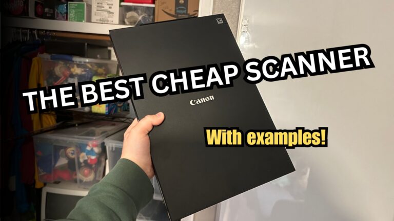
Archive the past with the Canon CanoScan I am very impressed with Canon’s small and powerful scanner,...
Read More
Google lens for nostalgia
Using Google Lens to find missing information
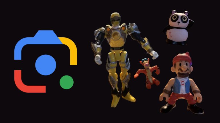
Google Lens is not a tool reserved for resellers. It offers practical image-to-text algorithms to help...
Read More
Using Yelp to find old photos of closed locations
Use old Yelp reviews to find photos of closed locations
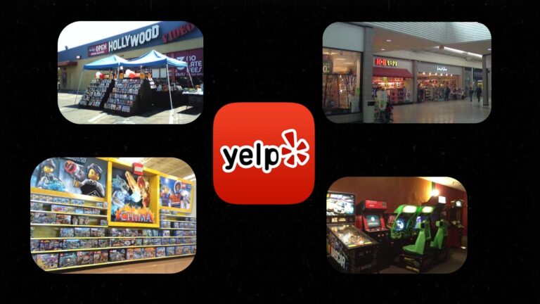
Yelp was a review site many used in the 2000s and 2010s. It was created to allow online users to look...
Read More

Leave a Comment

Your email address will not be published. Required fields are marked *